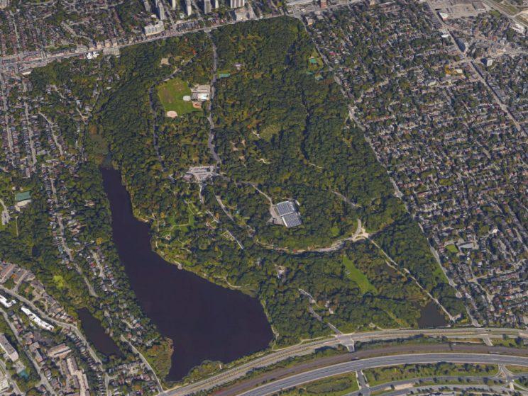
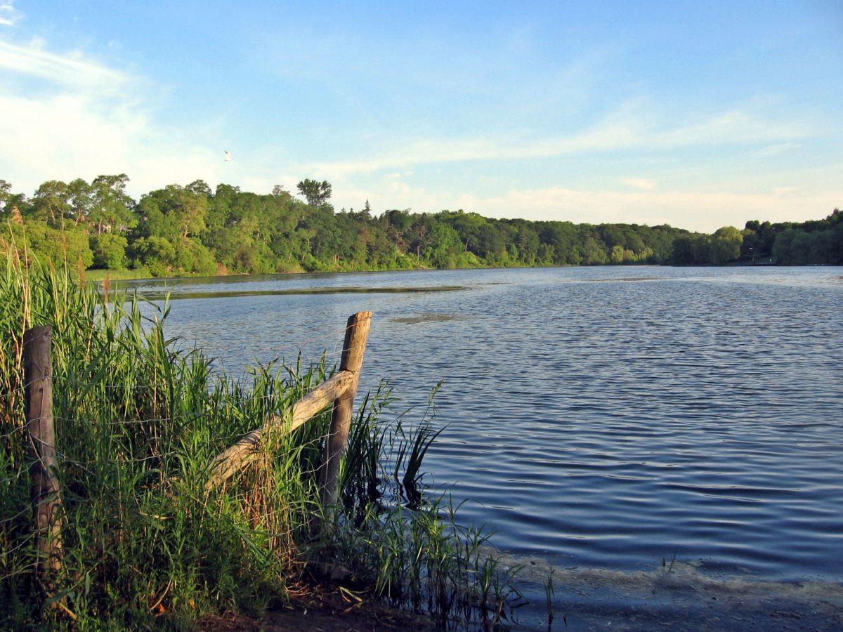
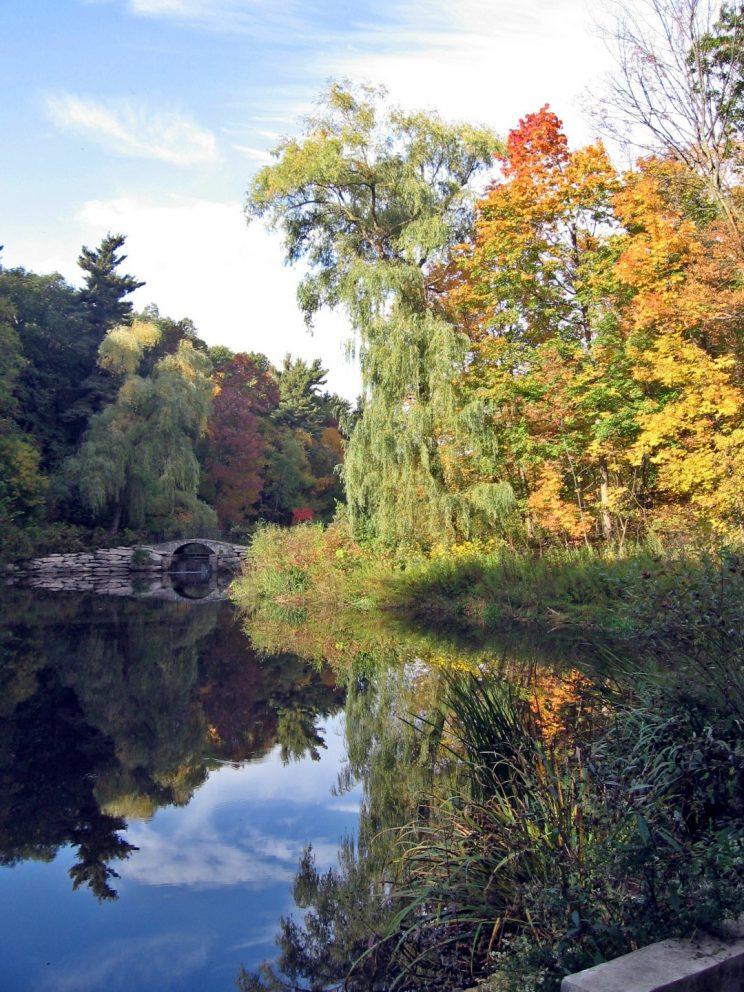
A kilometre long and half a kilometre wide, Grenadier Pond offers one of the loveliest vistas in High Park. Although much affected by development onsite and in the surrounding neighbourhood, this large natural pond still provides habitat to a wide assortment of water birds, fish, turtles and other wildlife.

Protection Status
Grenadier Pond is one of the areas within High Park that has been designated as an Area of Natural and Scientific Interest (ANSI) by the Ontario Ministry of Natural Resources based on a report by Steve Varga in 1989. According to this report:
The wetland communities at Grenadier Pond are noteworthy at the local level for harbouring one of only two remaining lakefront marshes in the City of Toronto, the other being the Humber River Marshes...The remaining wetlands at Grenadier Pond should be protected as a locally significant lakefront marsh which still supports regionally rare wetland species.
In April 2022 the Grenadier Pond Wetland Complex was declared a Provincially Significant Wetland (see evaluation summary). The evaluation summary includes a number of recommendations to maintain or improve these wetlands. The catchment area for the complex encompasses three watercourses: Spring Creek in the eastern part of High Park, Wendigo Creek which flows into Grenadier Pond on the west side of the park; and to the west an unnamed stream that enters West (Catfish) Pond in Rennie Park. The wetland complex is:
- probably one of the highest-use wetlands for public nature appreciation in Ontario…[and] scores the maximum value possible for education and research purposes
- supports 22 different vegetation communities…[and] a total of 53 significant flora and fauna species
- generally in fair condition considering its location in a heavily urbanized landscape
- complements the provincial Area of Natural and Scientific Interest which is focused on the oak savannah habitats, as well as the City of Toronto’s Environmentally Significant Areas (ESAs).
Size and Water Flow
Grenadier Pond is the largest of several ponds in High Park. Development in the surrounding drainage area has reduced its size from 19 ha in historical times to its present size of 14.2 ha. It is primarily fed by storm sewers and runoff from land to the west and east of the pond. To the south, the pond is separated from Lake Ontario by roadways, a railway and Sunnyside Beach.
Water from a pond to the west of Ellis Avenue (West Pond) also flows into Grenadier Pond approximately 30 m to the north of the southwest corner of the pond.
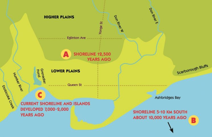
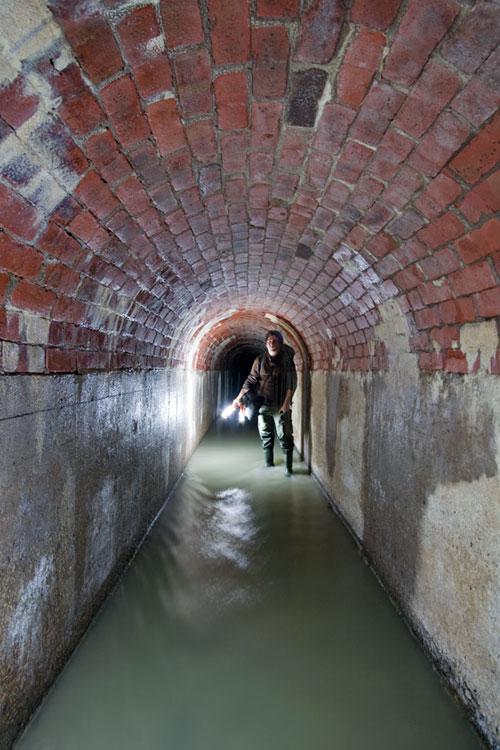
Historically Grenadier Pond was connected directly to Lake Ontario during occasional breaks in the bordering sandbar. The water of Grenadier Pond now drains through a surface outlet at the southwest corner of Grenadier Pond and then through a sewer into the Humber River before finally reaching Lake Ontario. The weir installed (after 1853) at this outlet to regulate water levels in Grenadier Pond was modified in 1996 so that water levels could be lowered seasonally to mimic natural fluctuations. In practice, however, this weir has not been adjusted for many years.
History of Grenadier Pond
A historic plan of the area from 1864 shows Grenadier Pond separated from Lake Ontario by only a sandbar and the ‘Lake Road’. The southern edge of the pond was marshland that extended east to connect with today’s Lower Duck Pond. During periods of high water (e.g., spring snow melt), Lake Ontario likely flooded over the sandbar, resulting in occasional flushing of the ponds and elevated water levels (Gartner Lee Ltd. 1995).
Mapping sources indicate that the surface catchment area for Grenadier Pond was much larger historically (47.7 ha) than it is today (24.5 ha), and extended as far north as St. Clair Avenue. When the lands surrounding Grenadier Pond were developed, the drainage system was extensively channelized into storm sewers, and much of the runoff from hard surfaces was diverted out of the catchment. These changes have resulted in a substantial drop in the annual volume of water directed to the pond from groundwater contributions.
The connection between Grenadier Pond and Lake Ontario was cut off in 1853 when the sandbar was widened with fill to accommodate the Grand Trunk Railway, and later widened further by road construction.
In the early 1900s, as the city grew around High Park and the demand for recreation on the pond increased, the marshlands shrank. Structurally, the pond has been “renovated” in successive waves of development, particularly on the eastern and western shorelines (Gartner Lee Ltd. 1995). Wainio et al. (1976) describe the land use changes that have occurred around the perimeter of Grenadier Pond since 1947, after which approximately 4.45 ha were filled to accommodate an expansion of the Queensway roadway, removing a large section of marsh that once rimmed the pond's southern shore. In the 1950s and 60s close to half of the pond's shoreline was dug up and replaced with turf grass stretching to a solid concrete edge to further increase recreational land.
Impacts on Nature
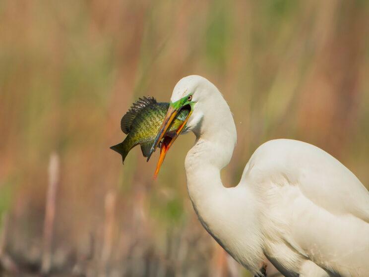
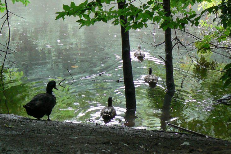
In the 1880s Grenadier Pond was encircled by rich wetlands that provided an important stopover for many species of migrating birds. The shoreline consisted of cattails, sweet flag, grasses and shrubs. The south end of the pond was a sedge wetland that provided spawning ground and habitat for painted turtles, pike, salmon and largemouth bass.
When the marshy shoreline was removed, the pike population dramatically declined, as did the number of migratory birds. Water quality also suffered, largely because of storm-sewer runoff, contaminated with fertilizers and road salt, flowing into the pond from the surrounding neighborhoods. This, combined with prolific droppings of Canada Geese and decaying sediments, overloaded the water with nutrients, causing an imbalance in the pond's ecosystem.
Growing awareness of the importance of preserving natural areas has sparked a number of restoration efforts aimed at rehabilitating Grenadier Pond (see below).

Rehabilitation
Major efforts to rehabilitate Grenadier Pond began in 1994. These included fish stocking (Largemouth Bass and Northern Pike), water quality surveys, and the propagation of native shoreline plants at the High Park nursery. Removal of most of the concrete curbs and restoration of the Grenadier Pond shoreline began in the southeast corner in 1995, and the southwest corner, East Cove and Maple Leaf shoreline in 1996. In 2005 another naturalization project extended the softened edge across the entire south shore of the pond. Shoreline plantings were implemented to enlarge the remnant areas of wetland remaining around the pond and to reduce the impact of waterfowl on the water quality of the pond (nutrient loading).
The Ellis Ave./Grenadier Pond stormwater facilities were constructed in 2006, following an Environmental Assessment study. This included the construction of a wetland at the southwest corner of Grenadier Pond, with a forebay that can be dredged as needed, and installation of oil separation devices on adjacent roads. The target was 75-80% reduction in suspended solids, as well as the heavy metals and bacteria associated with the solids. The changes were expected to result in cleaner water going into Grenadier Pond, more treatment of water flowing out of Grenadier before it reaches the lake, and reduced risk of flooding to adjacent properties. In 2007 additional restoration along the east shore of Grenadier Pond improved fish habitat through a series of underwater shoals, log cribs and root wads.


Sources
- High Park Woodland and Savannah Management Plan, City of Toronto, 2002. PDF (2 Mb).
- High Park: Restoring a Jewel of Toronto’s Park System (PDF), Kidd, Christensen and McEwen, Forestry, Parks and Recreation Division, City of Toronto, 2000. Revised and updated January 2008.
- ANSI Report - A Botanical Inventory and Evaluation of the High Park Woodlands, S. Varga, 1989. PDF (1Mb)
- High Park News, Fall 2006, Natural Environment Committee Update, Karen Yukich
- Grenadier Pond, A Self-Guided Walk through the Past (printed brochure)
- Proposals for the Rehabilitation of Grenadier Pond et al, Gartner Lee, 1995. PDF (14 Mb).
- A few historic documents at the High Park branch of the Toronto Public Library in the local history archives (do not circulate), including:
- An Ecological Study of Grenadier Pond, Wainio (1976) PDF Part 1 (29Mb), Part 2 (20 Mb), Part 3 (8 Mb)
- The Comparative Limnology of Grenadier and Catfish Pond, Zimmerman et al (1986). PDF (12Mb)
See also
- Natural History of Toronto's High Park
- Common Waterbirds
- Fish
- Amphibians and Reptiles
- Wetland Plants
- Torontoist article. Historicist: The Grenadier Ice Company. Ice harvesting. January, 2011.
- Spring Awakening at Grenadier Pond. Toronto Star article by Jennifer Wells.
- Why Grenadier Pond is called Grenadier Pond, and a Suicide. Toronto Standard article by Simon Wallace.
- Grenadier Pond Wetland Complex PSW Evaluation. TRCA 2022
- Water levels in Lake Ontario 4230–2000 years B.P.: evidence from Grenadier Pond, Toronto, Canada; Mccarthy and McAndrews, 1988